
This was my first trip to Lake Ingalls. For my second trip I stayed overnight. Read that trail report here.
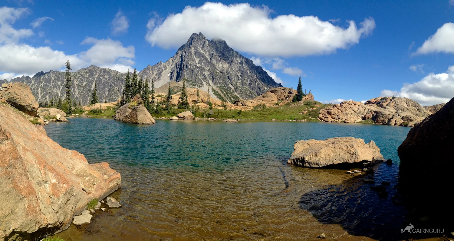
Lake Ingalls is located in the Wenatchee National Forest of Washington State. Getting there from Seattle takes a couple of hours with a formidable nine mile dirt road to deal with, but that doesn't stop it from being one of the most popular destinations in the Alpine Wilderness Area. The setting is idyllic with a stunning blue lake set high among massive boulders in the shadow of Mount Stuart, one of the craggy peaks composing the border to The Enchantments.
The hike takes you through the Teanaway Valley and up into the Alpine Lakes Wilderness, a protected land of over 400,000 acres and hundreds of alpine lakes and tarns. President Ford protected the land from development in 1976 and President Obama expanded the boundary in 2014. Prior to these dates the land was open to mining, timber extraction, roads and ecological degradation.
The path heads uphill through a pine forest before reaching open country near Ingalls Pass three miles in. The views are vast and open to Mount Stuart and Ingalls Peak in the foreground. There are two camping options at the pass with an upper and lower camping area where a basin expands to create grassy meadows with winding streams, waterfalls, wildflowers and larches. It's as if the Disney Imagineers planned out the space to emulate the perfect wilderness settings. You expect to see a cottage with seven dwarfs living here.
A short hike/scramble from the camping areas take you to the lake itself. There are cairn (rock piles) left from kind hikers, but even with those, it can be hard to know where to go next if this is your first time. I got off track several times and ended up scrambling over boulders until I rediscovered the trail, eventually emerging over a rise at the lake shore.
The lake itself is a clear blue-green when hit with the sun. It is surrounded by smooth boulders and giant stone slabs that reach to the sandy floor of the lake. The path (you can't really call it that) around the northwest end of the lake is barely there and requires some parkour moves, but if you can do it you will be amply rewarded by another pristine setting on the other side. Simply stunning.
I took the alternate trail back which connects to the main trail just before the campground area. When I reached the top of the final incline I was greeted by four mountain goats that had no intention of moving aside for me, so I shimmied across a rock ledge until I was an acceptable distance from the horns, and rejoined the trail again.


