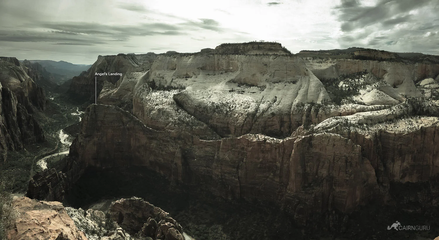

Zion National Park, UT - We happened to visit the park on the annual free admission weekend, so the crowds were pretty large. We knew we wanted to do Angel's Landing, but didn't want to navigate the spine of that trail while dodging tons of people. Instead, we put that off for a mid-week hike and chose one of the more difficult trails instead with the idea that there would be fewer hikers. Observation point is higher than and overlooks Angel's Landing, providing probably the most stunning views in the park. It's a difficult trail with a wide variety of landscapes. If you can do it, it's well worth it.
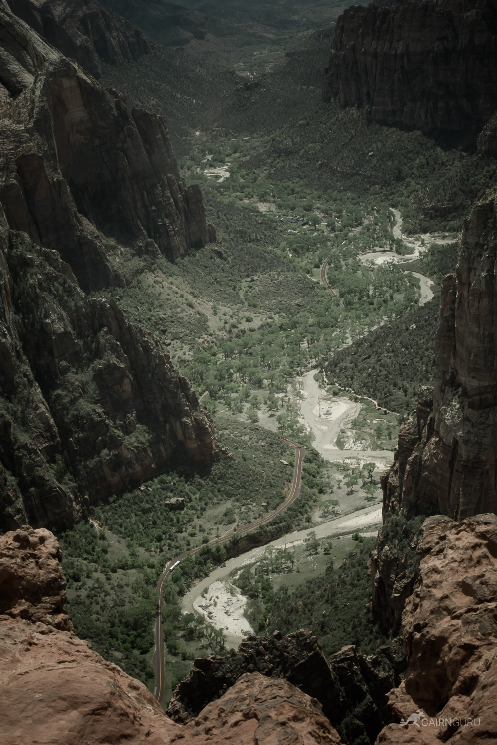
View of a shuttle in the valley below
Shuttles - ZNP is stunning. It's popularity grew so much that cars were becoming a problem, so a well-organized system was created for the millions of visitors the park welcomes each year. Shuttles carry you from the Visitors Center to the trail heads and alleviate the hassle of dealing with traffic and cars. The air is cleaner, the noise is reduced, and the experience is enhanced. You never have to wait more than a couple of minutes for the next shuttle to arrive. I thought I would hate it, but I loved it. Heading north you will hear the same pre-recorded audio, but on the return trip the drivers will provide commentary and point out fun facts.
The shuttle stops are numbered. You'll want Stop 7 for Weeping Rock which shares a trail head for Hidden Canyon Trail and Observation Point. Head up the switchbacks and follow the signs. The trail is beautiful and takes you through Echo Canyon where it mercifully flattens out before heading up again (no mercy) to the plateau that terminates at Observation Point where the struggle pays off.
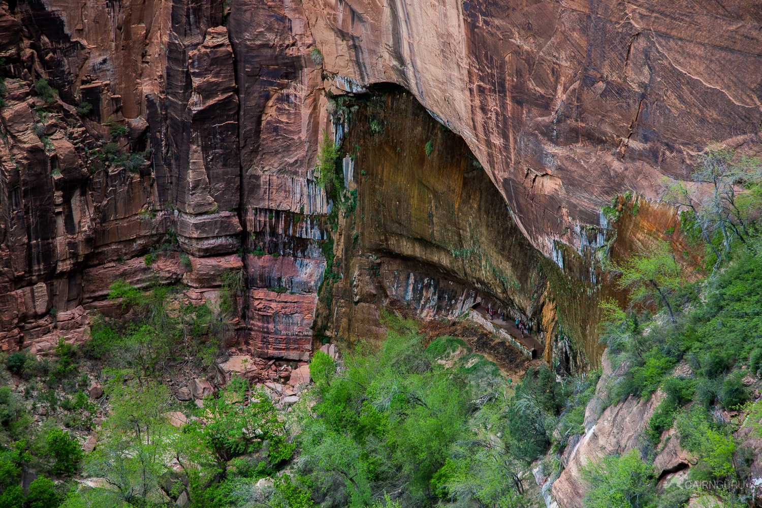
Weeping Rock
The trail is wide enough to pass others comfortably, but there were some who were hugging the wall at times. It's a great trail to acclimate yourself to the heights before tackling Angel's Landing. Bring lots of water and food. The top is sandy, comfortable, wide and offers plenty of picnic spots with views to (literally) die for.